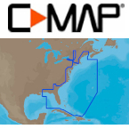
C-Map Electronic Marine Charts

C-MAP 4D Electronic Marine Charts

C-Map MAX Electronic Marine Charts

C-MAP MAX Lakes

C-Map MAX-N WIDE Electronic Marine Charts

C-Map NT+ Electronic Marine Charts

C-MAP Reveal Ultra Hi-Res Bathymetric Charts
Whether you're fishing in a region for the first time or want to explore a new cove, it's important to have correct information about the area. C-Map cartography products have been helping boaters catch more fish and have more fun since 1907, and at TackleDirect, we have more than 50 C-Map electronic charts to help you plot a course in almost any area of the world. Trolling for barracuda in the Caribbean? Searching for sailfish off the California coast? Headed for southeast Australia to usurp some kingfish? You'll always know exactly where to go with the right C-Map digital chart. Use PC-Planner to plan a route on your home computer and then transfer it to your chart plotter so you can stay on course even when you're in a strange land.


